Self Drive Itineraries

Hobart to Port Arthur

Our Hobart to Port Arthur Self Drive Itinerary and Drive Map is designed to give you a good look at the area between Hobart and Port Arthur as you travel between overnight stops.

It only takes just over an hour to reach the Tasman Peninsula on the direct highway, but this route will take you on a backroads diversion to show you some interesting rural countryside on the way.

Though not far from Hobart in a straight line (about 40 kilometres – 25 miles, but there is a lot of water you have to drive around), the driving distance to Port Arthur is over 100 kilometres (62 miles) by the time you follow this drive tour.

Hobart to Port Arthur Tasmania Australia

Hobart; Tasmania's capital; is a vibrant, culture and history rich city that is nestled between the River Derwent and kunanyi/Mt Wellington.

Credit -
Hobart to Port Arthur Tasmania Australia

The Richmond Bridge is the oldest stone span bridge in Australia.

Credit -
Hobart to Port Arthur Tasmania Australia

The Guard House was one of the first buildings to be erected at Eaglehawk Neck. Image thanks to Tourism Tasmania & Kathryn Leahy

Credit - Tourism Tasmania & Kathryn Leahy
Hobart to Port Arthur Tasmania Australia

Port Arthur - World Heritage listed historic convict site. Image thanks to Jack Mohr Photography.

Credit - Jack Mohr Photography

Hobart - Richmond

Featured stops  | Sorell Fruit Farm | Richmond | Dodges Ferry | Carlton Beach |

Leave Hobart by crossing the Tasman Bridge and drive towards Sorell and the Airport on the A3 Tasman Highway. 

As you climb over the hill leaving the suburbs, watch for the turn off to the left to the B31 Road to Cambridge and Richmond. 

Take the B31 Cambridge Road then turn and follow it as it heads north up the Coal River Valley as B51 Richmond Road.

Watch for the Frogmore Winery building on the right. The white radio telescope off to your right is part of the University of Tasmania’s Astronomy Department.

This was the old route followed by convicts and their guards to Port Arthur. The Richmond Gaol, in fact, predates Port Arthur as a correctional facility.

Things to see and do...

Richmond - Dunalley

Featured stops  | Sorell Fruit Farm | Richmond | Dodges Ferry | Carlton Beach |

After looking around Richmond, leave the township by crossing the Richmond Bridge and climbing the hills lining the Coal River Valley on the C351 Brinktop Road.

Over the ridgeline there are expansive views out over Pittwater and Midway Point. The causeways that now carry the Main Road were not built until 1872, shortening the land trip somewhat and cutting Richmond out of the journey.

When Brinktop road joins the A3 Tasman Highway, turn right and follow it to Sorell.

At the T junction in Sorell, turn right as the A3 becomes the A9 Arthur Highway. Watch for the turnoff to the Sorell Fruit Farm on the left as you leave Sorell and visit if that tickles your fancy.

Rather than follow the A9, you can turn off and follow some interesting backroads.

After the road dips down and crosses the River, climbs the hill, and then runs onto the flat land, watch for the turnoff to the right (towards the water) onto the Old Forcett Road to Dodges Ferry and Carlton Beach.

The road will become Lewisham Road and curve past the Pub to Dodges Ferry. Stay straight ahead to Dodges Ferry as the road becomes Carlton Beach Road.

Take a sharp right then left at the Post Office and General Store, before following the road as it winds to Park Beach. Stop for a walk on Park Beach (turn off to the right) or just follow the road as it climbs the hill, then runs behind the sand dunes before curving uphill to become Moomere Street.

Moomere Street joins Carlton Road. Turn right onto Carlton Road and follow it along the Carlton River. There will be some sharp turns, but stay with it.

Carlton Road will dead end into Sugarloaf Road. Turn right and follow the road downhill and across the bridge on the upper reaches of the Carlton River.

The road becomes Fulham Road and runs through Connellys Marsh and along the foreshore to join the main A9 Arthur Highway at Dunalley.

The views are spectacular, the road winding and fun, the drive is worth it for the more adventurous.

Dunalley - Eaglehawk Neck

Featured Stops | Eaglehawk Neck | Tessellated Pavement | Dog Chain

Cross the Dunalley Canal Bridge and follow the road towards Eaglehawk Neck and Port Arthur. Watch for the turnoff to the left to Pirates Bay Lookout.

It is well worth stopping for the views. Rather than going back to the A9, stay on Pirates Drive as it winds downhill to Eaglehawk Neck.

Lufra Hotel on your right at the bottom of the hill, is worth stopping for lunch, or to visit the Tessellated Pavement geological feature.

This is the old road, and sometimes these are more interesting than the modern bypass roads that replace them.

It was here that the infamous Dog Chain was established in the 1830’s. Fierce, half-starved dogs were kenneled in a line across the narrow neck to prevent escapees from Port Arthur getting off the Tasman Peninsula.

The equally fierce waters of Pirates Bay on one side, and the rumour that sharks infested Norfolk Bay on the inland side, made swimming to freedom a less than desirable option.

Things to see and do...

Eaglehawk Neck to Port Arthur

Featured Stops | Doo Town |Tasmanian Devil Unzoo |Remarkable Cave | Devils Kitchen | Port Arthur Historial Site

Turn left onto the C338 Blowhole Road and follow the signs to the amazing coastal formations at the Blowhole, Tasman’s Arch, the Devil’s Kitchen and Waterfall Bay.

You can spend several hours enjoying what are some of the most scenic coastline vistas in all of Australia.

Return to the A9 Arthur Highway, turn left and continue on towards Port Arthur. The road will follow the shores of Norfolk Bay (the inland stretch of water separating Port Arthur from the rest of Tasmania) and the vistas are excellent.

It is possible to see Mt. Wellington on the horizon – you can appreciate the proximity of Hobart, even though the road distance is quite long.

Drive through Taranna (yes, the “Tasmanian Devil Unzoo” on the right is worth stopping at) and then on to Port Arthur.

Just past the entrance to the Port Arthur Historic Site, the road becomes the B37 Nubeena Road and loops around the western part of the peninsula, returning to the A9 Arthur Highway at Taranna near the Tasmanian Devil Park.

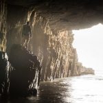
Remarkable Cave, just to the south of Port Arthur, is worth a visit. Stay on the A9 Arthur Highway past the Port Arthur Historic Site turnoff.

Just after the turnoff to the Port Arthur Historic Site, watch for the turn to the left onto the C347 Safety Cove Road.

Follow the C347 Safety Cove Road as it swings through Port Arthur township before dead ending into the Remarkable Cave parking area.

Things to see and do...
Want to Book This Itinerary?
Hobart - Richmond
Richmond - Dunalley
Eaglehawk Neck to Port Arthur
Book Yourself Booking Concierge Tasmania Australia Concierge Booking Email Search Top