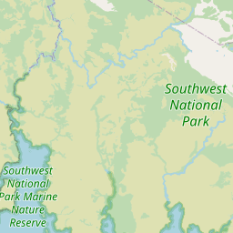

Location: Southwest National Park
Length: 4 kilometres return
Grade: 2 (suitable for most on a flat, easy-to-follow track)
Distance from: Hobart - 123 km, Launceston - 324 km, Devonport - 405 km
The Fishers Point Trail is isolated and presents you with gorgeous rocky headlands, pristine beaches and a bit of history. At the end of the beaches lay the ruins of a Pilot Station and Lighthouse, both built in 1843. But, if you're not from Tasmania, you might feel a little lost. The beaches are so soft with white sand and the water so crystal-clear blue that you might think you're in a tropical paradise. But you're closer to the Macquarie Islands of Antarctica than you are to the equator. It's a surreal, one-of-a-kind landscape in the southern reaches of Tasmania.
And you get a bit of bragging rights taking this easy track. It's within the confines of Southwest National Park which is the most rugged and wild land in the country. The trail starts at Cockle Creek which is the last sign of human existence heading south or west save for a small hiking station on the far southwest point of the island. Cockle Creek also serves as the endpoint of the South Coast Track where indomitable hikers are dropped off by plane or boat deep in the wilderness to climb their way out over 7 days. You might run into a few haggard hikers as you enjoy this easy, beautiful and isolated walk.
Getting There
Take the Huon Highway through Huonville for another 70 kilometres to the Hastings Caves Road. Follow the road for another 22 kilometres as it changes into Lune River Road to its end point at Cockle Creek. Find the trailhead at the whale sculpture.
The drive from Hobart takes a little more than 2 hours over 123 kilometres. Launceston is 324 kilometres and 4.5 hours away. Devonport is a 5 hour and 20-minute drive over the span of 405 kilometres.
The Trail
It's highly recommended to take this trail at low tide. Some of the trail disappears at high tide which makes it much more difficult.
The trail is absolutely delightful and well defined at low tide. You'll undulate over rocky headlands and down onto white sand beaches with incredibly clear waters. Just remember that if you find yourself introspectively gazing out over the water that you are not looking towards Antarctica. Instead, you're looking north toward the heart of Tasmania. But it's always a good idea to keep an eye out for dolphins, penguins, seals and whales.
After a short while, you'll finally find yourself at Fishers Point and the ruins of the Pilot Station and Lighthouse. Return on the same track to Cockle Creek after enjoying the isolation.
Precautions
Cockle Creek is the endpoint of the 7-day South Coast Track through the rugged wilderness of Southwest National Park. It's a good idea to pack food, water and blankets in case you run into distressed hikers.
Do not get stranded at Fishers Point at high tide. The trail becomes much more difficult as some of it disappears underwater when the tide rolls in. You can check the tides online.
Weather can change rapidly in the southern reaches of Tasmania. Pack something warm that is resistant to all kinds of precipitation.
The beaches along the trail are remote without lifeguards. Enter the water at your own risk.
Pets are not allowed in Southwest National Park.


