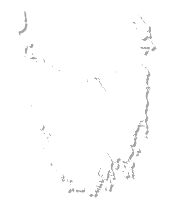
Summon up a map of Tasmania and take a good look. You'll find Hobart in the southeast with plenty of roads leading north to Launceston and Devonport. Then take your eye down to the southwest of the island to see a large swath of green. Look closer. There are no roads, no towns and only one tiny port on the southwest tip of the island. You're marvelling at Southwest National Park and all of its wild glory. You'll find the South Coast Track along its southern edge.
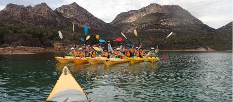
Spanning 85 kilometres from Melaleuca to Cockle Creek, this walk takes 6 to 8 days to complete. It meanders through some of the wildest lands on planet Earth, and, because of this wildness, it is recommended that you gain experience on some of Tasmania's other difficult walks before challenging yourself on the South Coast Track. The Overland Track in Cradle Mountain-Lake St Clair National Park serves as a good warmup.
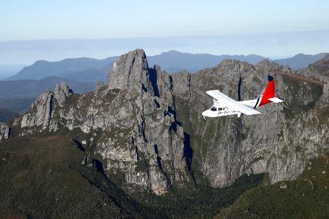
While there is a rugged road to Cockle Creek, there are no roads to Melaleuca. The small encampment on the southwest side of Southwest National Park has a small airstrip and Port Davey for the landing of boats. You can only fly, boat or walk your way out of Melaleuca. Boats and planes can be arranged in the west coast town of Strahan.
It is advisable to take the track during the summer months. It is warmer between September and March but you are at risk of high winds, cold temperatures and a deluge of rain at any time of year. And while it is possible to complete the track alone or during winter, it is highly inadvisable to complete the track alone in winter. After all, you're a long ways from help if you need it. Always hike in groups of 6 or less.
It is essential that you pack just the right amount of equipment for your hike. If you overpack, you'll be weighed down by superfluous materials. If you don't pack enough, you could put yourself in danger during nasty weather.
Here is an essentials packing list according to the Tasmanian Government:
- backpack
- backpack liner to keep everything dry
- all weather tent
- sleeping bag rated for -10°C
- sleeping mat
- waterproof coat with hood
- waterproof over trousers
- walking boots with ankle support
- gaiters
- long sleeved thermal tops and bottoms
- moisture-wicking walking close
- warm sleeping clothes
- beanie
- gloves
- sun hat
- sunglasses
- sunscreen
- first aid kit
- pocketknife
- whistle
- compass
- toilet trowel
- toilet paper
- antibacterial hand gel
- fuel stove with fuel
- waterproof matches
- torch with spare batteries
- food
- cooking pot
- utensils
- scourer
- water bottles
- toiletries
- medications
- map
- guidebook
You may also choose to pack optional gear such as a camera, binoculars, trekking poles, GPS, card games and thongs.
There is only a rustic campground at Cockle Creek. Walkers must be self-sufficient and able to camp the first night that they arrive at the trailhead.
Maleleuca features a small airstrip, two Bushwalking huts, a composting toilet and a rainwater tank. However, you can take the small path to the Deny King Memorial Hide to catch a glimpse of the ultra-rare Orange-bellied Parrot. There are less than 50 of these tiny little birds left in the wild.
You'll find booths with extensive logbooks at each of the trailheads in Maleleaca and Cockle Creek. Be sure to write down your intentions before entering the wilderness as it may help to save your life. And make sure to sign the other book as you leave. These logbooks are not regularly checked by authorities and searches will only be conducted if other walkers report you missing or overdue. Accurate logbook information is also used for property management purposes.
There are no huts along the South Coast Track. You'll only find two huts at the trailhead in the remote area of Maleleuca. These two huts accommodate up to 20 people and offer up rainwater and mattresses, but there are no cooking facilities. A fuel stove is essential for your hike.
There is an extensive list of recommended campsites along the hike. Here are the expected walking times between campsites on the South Coast Track. It is recommended that you take the hike from station to station when weather permits:
Melaleuca Campground to Cox Bight Campground - 13 kilometres, 4 hours
Cox Bight Campground to Louisa River Campground - 17 kilometres, 6 hours
Louisa River Campground to Deadman's Bay Campground - 12 kilometres, 10 hours
Deadman's Bay Campground to New River Lagoon Campground - 9 kilometres, 4 hours
New River Lagoon Campground to Granite Beach Campground -12 kilometres, 5 hours
Granite Beach Campground to South Cape Rivulet Campground - 9 kilometres, 7 hours
South Cape Rivulet Campground to Cockle Creek Campground - 12 kilometres, 4 hours
You'll find small boats at New River Lagoon. You'll need to use the small boats to cross the Lagoon only when weather permits. It is a good idea to take extra food in case you are delayed at this water crossings.
It is imperative that you use these boats according to the rules. You'll find boats attached to cables at each side of the Lagoon and these boats can be difficult to drag if your hiking alone. Leave the boats fully secured with its oars for the next person. If you are having trouble dragging it along the beach to the water, you may want to wait for high tide. And once you tie your boat up, look for temporary signs that will get you back on the South Coast Track. Shifting sand dunes can make the track difficult to find.
Water found in the Tasmanian wilderness is fairly pristine but may not meet international guidelines for drinking water. Health risk is low but you should still treat water by boiling for three minutes especially when water levels are low. And always test water for salt near the ocean.
Wash any dishes using hot water with no soap. Soaps can contaminate the land even if they claim to be biodegradable. And all washing should be done at least 50 metres away from a water source.
You must packout all items that you pack in. This includes tampons, wet wipes and condoms. Toilet paper may be buried with waste.
The only toilets on the entire South Coast Track are at the remote hiking station of Melaleuca deep in the wilds of Southwest National Park. Waste must be buried at least 100 metres from any water source or campsite. Dig a 15-centimetre hole to bury your waist and toilet paper then cover to hide from animals.
Open fires are not allowed on the South Coast Track. Fire sensitive vegetation is found all throughout Southwest National Park and fuel stoves are a must. Most of the flat campsites are located atop peat which can burn easily.
Most of the South Coast Track is exposed to southerly winds that bring cold rains. Rains come through the area every second day during the warmest summer months and it can rain even more frequently during the winter. And weather can change dramatically on the Ironbound Range which ascends nearly 900 metres. It is not uncommon to find yourself caught in a hail or snow storm during any season. Be ready to hunker down for an entire day in an emergency situation because there are no campsites in the Ironbounds.
Granite Beach and the Unnamed Bluff at Cox Bight can be overcome by ocean waves when seas are rough or high. This can happen unexpectedly and it can lead to streams being overcome. The South Cape Rivulet, the Louisa River and the Faraway Creek should not be crossed when waters are high.
All Tasmanian snakes are venomous so it is imperative that you bring a first aid kit on your South Coast Track walk. Most snakes are shy and will leave you alone but it is advisable to wear sturdy boots that protect your legs from snakebites. It should be noted that death by snake is very uncommon but you should seek immediate medical attention anyways.
Day One -- Melaleuca to Point Eric at Cox Bight
Whether you fly or boat to the trailhead at Melaleuca, you'll get a sense of the wild grandeur of Southwest National Park. The first section of the track is well defined and even features boardwalk over particularly muddy parts. You'll hug the side of the New Harbour Range and the Freney Lagoon before descending to the soft beach at Cox Bight. There are two campsites at Cox Bight -- one right by the lagoon and another further along the track at Point Eric. Point Eric is recommended due to the ease of the first day of walking and the fact that it is sheltered by trees. You can find fresh water a few hundred metres up the beach at Goring Creek.
Day Two -- Point Eric to Louisa River
The second day starts with a couple of kilometers on a sandy beach before crossing Pender Creek and finding your way around the Black Cliffs. The track continues along the beach before heading inland for a handful of kilometers through scrubby planes. The track you can get quite muddy even during dry summer seasons so make sure you pack waders. The track then ascends steeply over the Red Point Hills off in the distance before coming down the other side. Here, you'll find a small creek of freshwater suitable for filling water bottles before descending to Faraway Creek. If water levels are low, it's an easy crossing. If water levels are high, you'll have to use the built-in steps and rope to get across. You'll then have to navigate hot open planes before reaching the cool tree shade of Louisa Creek where you'll find another rope if water levels are high. You'll find campsites on both sides of the river.
Day Three -- Louisa River to Deadman's Bay
You'll have to traverse the 900-metre high Ironbound Ranges before finding your way to the next campsite at Deadman's Bay. Weather in the Ranges can change rapidly so scout the skies before making your ascent. You'll quickly leave the shade of the canopy at Louisa River to enter exposed, hot plains before rising into the Ranges. Most of the climb takes place in the first five kilometres so make sure your water bottles are full. This section of the hike can be rather heartbreaking. The track you can look incredibly steep out in front of you and another hill appears just as you summit the one in front of you. Take it one rise at a time and you'll eventually find yourself on the boardwalked track at the top of the Ranges where weather is cooler. Wind can howl and the track can be quite treacherous at the top, but, before you know it, you'll be navigating through a light forest and across a freshwater Creek to the well defined campsite at Deadman's Bay.
Day Four -- Deadman's Bay to Prion Beach
The first half of day four is rather muddy. You'll leave the forest around Deadman's Bay and walk across a muddy plane. Mud can be knee-deep even without rain. You'll trudge through mud, mud and more mud as well as a small creek before entering another forest at Menzies Bluff. You'll then cross a few more muddy flats before arriving at Prion Beach. Here, you get to clean up using provided brushes hanging from a sign reminding you to remove all the mud from your shoes and gear before heading down the beach. A couple kilometers down, you'll run into the New River Lagoon boat crossing.
Here you must follow very specific and exhausting instructions:
1 find the boat tied to your side of the lagoon
2 row the boat to the other side of the lagoon
3 hitch the other boat to your boat and tow it back
4 tie up your towed boat for other hikers
5 row back to the other side to make the crossing
On the other side of the lagoon, you'll find your campsite.
Day Five -- Prion Beach to Granite Beach
You'll follow the outlet of the New River Lagoon before heading into light forest. You'll find ladder steps that take you down to Milford Creek where you'll have to make another crossing. You'll then ascended steep steps to the forest-covered Weirah Hill where you'll find a lovely flat walk to Rocky Plains. The vegetation opens up and gives you incredible views across some of Tasmania's wildest lands. You'll then undulate up steep climbs and discents through a forest to Surprise Bay. You'll reach the beach and walk to a rivulet before heading back inland up a steep track to an elevated campsite. You can choose to rest here, where you'll find beautiful views of the beach below, or you can continue on to Granite Beach. It's a steep climb through thick scrub forest to reach Granite Beach where you'll find the sand eventually turns ankle-breaking rocks. There is a waterfall that serves as a convenient shower before you hit a Creek Crossing and an ascent to a large campsite.
Day Six -- Granite Beach to South Cape Rivulet
Heading out of Granite Beach, you'll meet a steep 400-metre ascent through muddy forest before hitting Flat Rock Plain. Take a minute to enjoy the views that you just earned before undulating up and down through muddy forests once again. You'll eventually come to Trackcutters Camp right before a steep descent. It can be quite slippery and muddy, and you'll find plenty of boardwalk along the way. At the bottom, you'll find another short climb before leaving the forest at South Cape Rivulet. You'll find the campsite along one of the rivulet's banks with a long, sandy beach below.
Day Seven -- South Cape Rivulet to Cockle Creek and Civilization
Leaving the rivulet, you'll enjoy a sandy walk across a long beach. You'll then climb up and over a headland to South Cape Bay Beach. The track then turns inland to climb sharply to Coal Bluff where you'll find beautiful views of the two beaches you just crossed. You'll then descend to find Lion Rock in the distance. The rock looks like a resting lion rising out of the azure blue ocean. You'll find a few campsites at Lion Rock but today you'll head to Cockle Creek and the end of the track. It's only seven more kilometers on a flat boardwalk to Cockle Creek and the road that takes you back to civilization. Make sure to sign the hikers registration book as you leave the South Coast Track and it's 84 kilometres of stunning wilderness.